Below is our validation guide for developers and agents. Please use these as good examples and what we look for when validating an application. Our guide covers:
- Site Location Plan (Best Practice)
- Site Location Plan (Certificate A)
- Site Location Plan (Certificate B)
- Description of Development: Common Householder Developments
Site Location Plan (Best Practice)
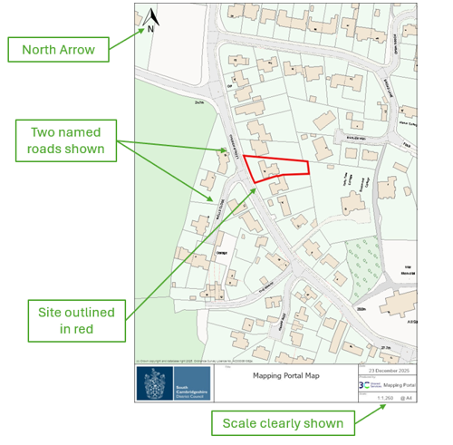
A Location Plan should be based on an up-to-date Ordnance Survey map and:
- be at a metric scale of 1:1250 or 1:2500
- include a direction North arrow
- identify sufficient named roads and/or buildings on adjoining land to ensure the exact location of the application site is clear
- show the application site edged in red and include all land necessary to carry out the development, including a link to the public highway
- show other land owned by the applicant, close to or adjoining the site, edged blue.
Key features of a Site Location Plan
- a North arrow
- 2 name roads shown
- the site outlined in red
- a clear scale
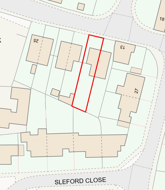
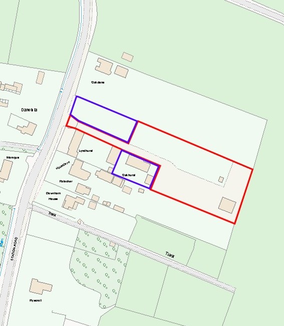
Site Location Plan (Certificate A)
Certificate A – Sole Ownership and no agricultural tenants:
This should only be completed if the applicant is the sole owner of the land to which the application relates and there are no agricultural tenants.
Below are some common examples, where all land within the red line (connecting to a highway) is within the ownership of the applicant:

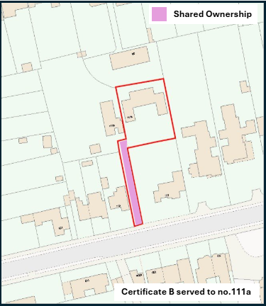
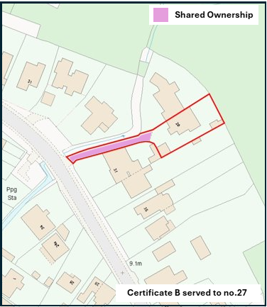
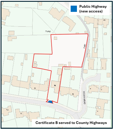
Site Location Plan (Certificate B)
Certificate B – Shared Ownership (All other owners/agricultural tenants known):
This should be completed if the applicant is not the sole owner, or if there are agricultural tenants, and the applicant knows the names and addresses of all the other owners and/or agricultural tenants (notice 1)
Below are some comment examples, where land within the red line (connecting to a highway) has another owner alongside the applicant:
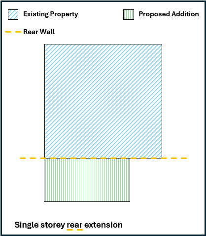
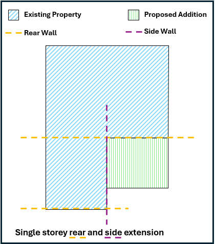
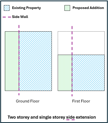
Description of Development: Common Householder Developments
Planning application descriptions should be accurate, clear and precise. A description should identify the key parts of the proposal that require planning permission, including scale and location, but not include irrelevant details or set out a justification for the proposal.
Below are some comment examples of householder developments, clearly stating the scale and location of the proposed development.